Friday, November 11, 2016

Pony Therapy

Before I explain pony therapy I'll catch up on Blue Ridge Parkway; the Virginia portion.  After my  hilly bike ride of the previous day (mentioned in my last post), I started out my morning a little slow but got it in gear to enjoy a great 10 or so mile hike on the Rock Castle Gorge trail. Apparently, somewhere along the route there are rock crystals that reminded folks of castle turrets; hence the trail name, but I didn't see any of the crystals. The trail started out with a long, steep descent into the gorge. Parts of the trail were narrow with exposure and blanketed in thick, slick leaves. Deep in the gorge there were more leaves remaining on the trees than in the more exposed places, where trees have lost their leaves (fall has fallen).


Once I hit the bottom of the gorge, the trail started a gentle uphill along a stream, but was still heavily wooded so not much for views. I can't quite figure out what the strange tree (or root system?) in the photo below is, but it was interesting.  The ascent got steeper and finally broke out of trees as I got closer to the top. Thanks to ladders like the one pictured below, the route included a number of cow pastures and, of course, cows.


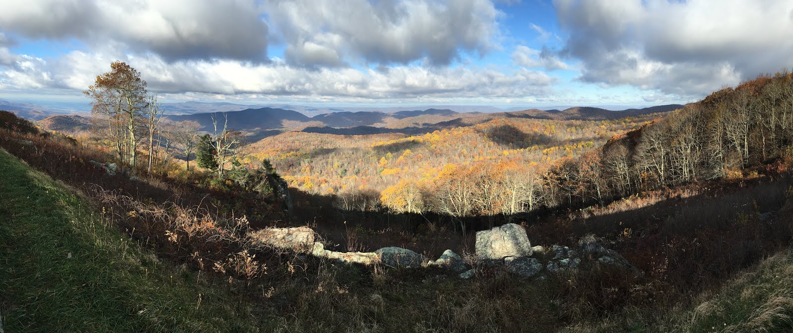
It was such a treat to break out of the trees into the sunlight and expansive views of farmlands.


As I was getting close to the top of the hike up I came across 2 white tail deer; a 3 or 4 point buck and a doe but I didn't get very good photos.  The views from and near the top were very nice and the stroll through the open pastures in the sunshine very rewarding.


The next day I took a variety of short hikes along the Parkway, including visiting a display of historic Appalachian way of life, including a picturesque, water-wheel-driven grain mill, pictured below along with the stones used in the grain grinder.


From there I headed north toward the highest point in Virginia. I spent  election night in a Walmart parking lot, not quite reaching my destination -- Grayson Highlands State Park. I woke up at 2 am and checked election results and again at 3. When I woke up again in the light of day, I wondered if perhaps I'd dreamed my wee hours news gathering? Nope... As I was driving I fretted about what might become of our nation, but the decision is made. All we can do is hope for the best.

Once I arrived at Grayson, I selected my campsite for the next 2 nights and headed off on my hike to the top of Virginia -- Mt. Rogers. I knew there would be no view from that summit but the views on the way up to the woods were truly amazing, and the "wildlife" was very therapeutic. My concerns over election results were soon replaced with great happiness.


The scenery is quite different than what I'd been seeing but what made it totally delightful were the ponies. It used to be that cattle were grazed in the highlands to fatten them  up before they were sold. But once it became a park, the cattle were no more and the habitat became overgrown. So they introduced wild ponies as "weed eaters".  They round them up once a year for a health check and sell off a few to keep the herd size under control. They are hearty little beasts that can survive the windswept highlands year round.

t

Guess what? Ponies can't read. And they are so darned cute that when they are nuzzling around, you can't help but pet them (it also keeps them from nibbling at you).


It was fun to interact with them; they made me happy and they really add to the beautiful views of the area.


Some of the ponies had amazingly long manes. It's a wonder they can see through them.


I hiked for 3 days (40 miles) in Grayson Highlands. The first day I hiked up into the clouds to the highest point in VA. I knew there would be no view so it didn't matter that the clouds were descending. I had views on the way up but coming back down, the clouds had settled in even at the lower elevation and there was blowing snizzle (snow/drizzle). I was happy to settle into my van and turn on the heat as the wind gusted outside. The next day started out windy but the afternoon was amazing with almost no wind and no clouds. What a difference a day makes! It was so peaceful that I stayed at length at numerous highpoints to enjoy the views. It would have been a perfect night for a fire at my campsite but by the time I got back, the place that sells firewood was closed and they discourage local wood gathering. Today the winds didn't die down and high clouds were forming but there was no precipitation.

I don't like driving at night so once I finished my 14 mile hike late this afternoon I started heading back toward Blue Ridge Parkway, North Carolina and got as far as the same Walmart parking lot before it got too dark.  Tomorrow it's back to the Parkway to resume my explorations on my southward journey.

Sunday, November 6, 2016

Shenandoah & Blue Ridge Parkway

After I finished my last post at a foggy pullout I hiked down to Rapidan Camp, Herbert Hoover's Presidential Retreat (the function Camp David serves today, the latter established by the next president). Because it wasn't a weekend and it was late in the afternoon I was the only hiker there. Staff were busy shutting down the camp so I didn't get to tour the former president's house but got to read the history in a display at the Prime Minister's House and enjoy the tranquility of the setting. Hoover was an avid fisherman and loved hearing streams so they rerouted the water from two nearby streams to create a nice flow below his house. The photo below of the wooden deck shows the view from the President's house, with the water just 25' below.


I was thinking of my fishing friends when I took this photo. 

This was a light hiking day, steeped in history.  The Visitor's Center I visited in the morning had a very good display of the park's history. I couldn't help but have mixed emotions. I am an advocate of National Parks that preserve the wilderness for future generations. But it had never occurred
me that when parks were established in areas of high population density (i.e., the first areas in America to be colonized) that it would require that people be displaced from their homes, whether they wanted to be or not. Some of the government's tactics to get people to give up their lands were less than reputable and the purchase prices not always fair. Only the elderly were allowed to stay on their lands with the understanding that when they passed their land belonged to the park. Others attempted to fight to keep their lands but lost their battles. I ran across some history along the Blue Ridge Parkway with similar scenarios.

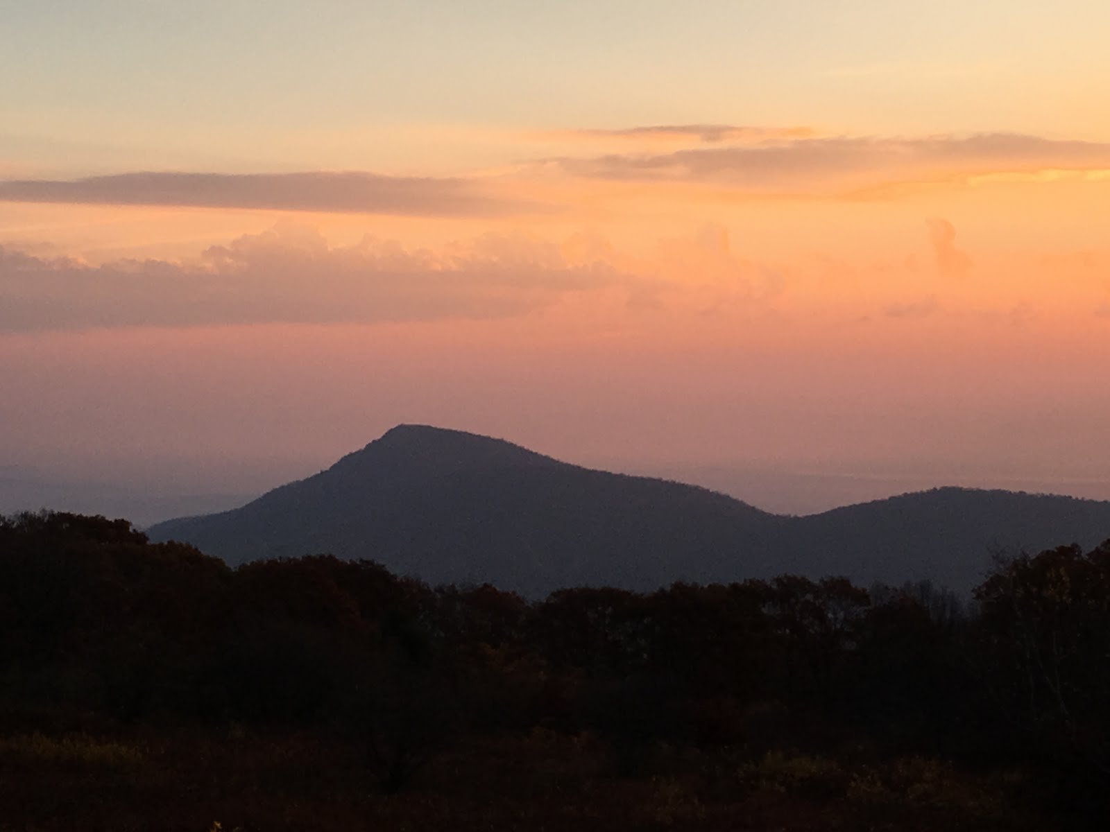
I enjoyed some lovely sunset views on my way back to the campground after my Rapidan hike. There were rain clouds forming that made for some interesting lighting (see 2 photos below), but it made me wonder about the forecast of clear weather for the next day, when I planned to tackle the iconic hike of Shenandoah -- Old Rag.


It rained that night but the next morning dawned clear. The trail head for Old Rag is located outside of the park; about 1.5 hours drive from where I was camped. I stopped at several overlooks to photograph sunrise colors on my way to the hike (photos below). The valleys on the west of Skyline Drive were filled with fog.


Old Rag Mountain, my destination for the day's hike.


Old Rag is a 9.2 mile loop hike that involves some pretty serious rock scrambling if you go from the Old Rag parking lot and opt for the scramble route. There were some big steps and a good arm workout to pull yourself up or ease yourself down between big rocks. I trashed my favorite hiking shorts. I'd half trashed them on the long Mt. Adams glissade (under rain pants even!) that Diana and I did in August. but a few slides down rocks during the Old Rag scramble finished the job. The route up traversed through a lot of the rocks you see in the photos. I was happy for a sane way back (down a normal trail and along a fire road back to my van).


There were still pockets of fall colors here and there. Despite the 1.5 hour drive to the trail head and back, I managed to get the loop hike in, get some groceries and gas and get back to the park as the sun was setting.


The next day I hiked to the top of several small peaks and did a hiking loop that went down, down, down to a single water fall and back up again. There is no shortage of water falls in Shenandoah.


It rained hard for several hours that night. I was SOOO happy to be snug in my van, nestled between sheets, rather than in a tent in a clammy sleeping bag. The next morning I watched a man pull his very soggy sleeping bag out of his tent. The rain fly was plastered down to the tent. He wasn't there early in the morning so I don't know whether he bailed during the night (to the nearby lodge?) or just went for an early morning drive to warm up.

The heavy rain and accompanying wind overnight  cleared out the haze. I was on my way out of Shenandoah by way of 3 different hikes and was happy for more expansive views.


In my 5.5 days in Shenandoah National Park I hiked 45 miles and drove the 105.5 mile length of Skyline Drive (parts of it several times). Only 1 campground was open but because I was there late in the season, on  weekdays, there was no problem getting a campsite and prices just went on late fall discount ($17/night).

So here's where I need to gush about how much I love my van. Usually when I hike this much I grow tired of freeze dried or dehydrated food and wind up craving crunchy green salads, fresh fruit, cold beer, and ice cream. But when I get back from a hard day of hiking, all of that is in my fridge!  When it rains at night I don't have to hassle with packing up a wet tent the next morning and pitching it, still soaked, the next night. There are still things I'm learning the hard way about all its bells and whistles but for the most part it's been relatively problem free and oh so wonderful.

On my last day in the park I  squeezed in 9.15 miles of hiking and caught one last sunset at the southern end of Shenandoah. Thanks to an "All Stays" app I downloaded that directed me there, I spent the night in the parking lot of a nearby Cracker Barrel Restaurant (a new one for me). They don't mind a few RVs in their parking lot overnight and of course I felt obligated to go inside for a restaurant meal. But the crowds of people and the noise inside felt like culture shock after a quiet week in the park.

I hopped on the Blue Ridge Parkway the next morning. It's an amazing National Park -- a 469 mile long  road that offers scenic driving along a ridge in the Appalachian Highlands of Virginia and North Carolina. Because it's late season and post fall-color splendor, it's an amazingly peaceful drive with little traffic. I drove most of the day yesterday, stopping for short hikes at a variety of scenic overlooks.


Today I had intended to resume driving but, checking on line, I discovered that the park I needed to camp in to do the 2 hikes I want to do is closed for 2 days for a managed deer hunt. No worries. I'm making it up as I go so I changed plans at about 10 this morning. I left my van at the scenic campground I was in lastm night and hopped on my bike for a hilly 34 mile ride. I started out riding a quiet county road into Floyd, VA, then rode south on Hwy 8 to hop on Blue Ridge Parkway and head north, looping back to the campground.  The long climbs up hills (it's a ridge after all!) really wore me out! Somehow I missed taking photos that would demonstrate just how hilly the ride was but enjoyable (except for the last few hills near the end of my ride.  The weather was pleasantly warm sunshine. Once I got on the Parkway it was amazingly peaceful, with very little northbound traffic coming up behind me, and only slightly more traffic southbound.

We'll see what tomorrow brings. Theoretically a 10.5 mile strenuous hike on the Parkway but time will tell.


Tuesday, November 1, 2016

Shenandoah National Park

By the time I finished the drive, including downloading an app to tell me where I might find places that would refill my propane tank (it also tells of dump stations, campgrounds, Walmarts, Cracker Barrels where one can park overnight), and detouring to get my tank filled, I arrived midday to the northern entrance of the park.  It was a sunny Sunday and the place was PACKED. I had to laugh. I drove straight through for 1 1/2 days to escape traffic and WHAMMO! TRAFFIC! But it was slow (<35mph) and you could predict where the backups would be (scenic overlooks) and signs warned you they were coming up.


But these sorts of traffic jams have been happening
since the park was created in the 1930s.


What? Is my car blocking traffic? Well, there's no place to park at this overlook and I MUST get my photo!

The fall colors peaked last week so there are a lot of trees without many leaves and thick carpets of brown leaves on the ground, which are quite slippery if you are trying to walk down a steep slope on such a carpet. But there are still nice pockets of vivid fall colors, enough to keep the leaf peepers happy. I admit to feeling a bit smug when I drove past folks taking pictures of past-prime colors. I took my share of pre-prime shots before I hit prime colors so it was easy to pass up the hordes of folks taking photos in some of these places.

I was a bit dismayed at the amount of pollution visible on the horizon. But I am not that far from those high populace places...


The sign at the north entrance to the park said all but one campground were closed and the open one was full. What?! Surely that can't be right! Don't these folks have to go home and back to work??! Even though I'd been driving for several days and REALLY wanted to get out and hike, I resisted the urge and made my way to the campground (55 miles down Skyline Drive), to see if I could find a place to call home.  I joined the hordes pulling out at scenic overlooks to grab and photo and keep driving, wanting to get to the campground early enough to maybe get lucky, since it's first come, first served. Sure enough, PLENTY of places. I grabbed a nice one at the back end with a filtered view. The Appalachian Trail passes within 15 feet of my campsite. I paid for 3 nights there.

I figured it was a good afternoon to catch up on chores. Since I was very short on exercise, I decided to walk to take a shower, carrying 2 heavy bags of dirty laundry. That was fine on the front end. By the time I got out of the shower I switched my load and walked back to my van to dump my shower stuff. It was quite warm (78 degrees) so, for the first time in weeks (!), I opened up 3 windows in my van to let the breeze blow through the screens and headed back to the laundry. There was a very light sprinkling but there hadn't been anything worrisome in the forecast. As I was folding the laundry the sky fell -- it was POURING! It also turned dark but I'd expected that so I had my headlamp. The rain eased (I thought) so I grabbed my bags of laundry and ventured out. Into thick fog! Heavy rain on hot, wet pavement. OOF! And the torrents returned. One of the bag, the plastic one (the other was cloth), started to fall apart.  I was clutching that bag with the cloth one over the top and trying to decipher what was under my feet to find my way back to my van. I ducked into a bathroom (might've even been a men's but I didn't care) to reorganize to make sure the remains of the plastic bag would keep my laundry contained (and the sheets for my bed semi-dry) and ventured back out into the torrents. I managed to find my van and was dismayed to see just how much of those torrents had made their way inside through those recently opened windows (including my mattress, sigh...). Oh well...

I had been thinking, when viewing the haze, that it needed to rain hard overnight to clear things up! I got my wish. Or mostly. There was still a fair amount of haze the next morning once the cloud cover cleared off. I started my hiking early enough that when I neared the first summit, it was fogged in, but I'd planned a circular route around the summit (highest point in the park) so I made my way around and by the time I reached the top again it was clear.


Assuming they load, the photos above show my campsite and the colors just before the sun went down. The next batch below show my hiking for the day. On top of the first summit (Hawksbill; photos below) I met some local hikers, soon to celebrate their 50th wedding anniversary. He asked me if I was a "High Pointer" and told me there was a club and they have annual conferences around nation, near a different state's high point each year. He was a serious "High Pointer", having hiked to the top of 49 of the 50. He settled for flying over Denali, since he didn't start this pursuit until after he'd retired and by the time he could've gotten in AK's highpoint, it was more than he should be tackling (though he looks pretty spry!). The granite-topped mountain in the photo below is Old Rag, I'll be hiking that one tomorrow (Nov 2nd)  since the sun is supposed to shine.


I finished my first hike midday, even with the much slower pace I took back to the parking lot to keep chatting with my new found friends. She had had a stroke in March so wasn't as sure on her feet as she used to be.  But she was getting around really well.

I still had plenty of energy after my 5.25 mile hike so I took on the 'strenuous' all-day hike nearby -- a 7.1 mile circular route that included 2 ravines and many water falls and still had some nice fall colors.


This morning there was intermittent light drizzle and VERY dense fog so I stopped at the Visitors Center and learned about park history and picked up info for my next hikes. Then I drove to a nearby lookout (overlooking fog) that had good cell coverage and got caught up on some business. As I finish this the sun has come out so it's time for an afternoon hike. :0)

It looks like folks are viewing my posts so I'll keep at it for you and for me!  Join me if you can!