Thursday, December 8, 2016

Thanksgiving into December in TN, SC, and GA


I had a lovely Thanksgiving hike in the Smoky Mountains. It was a very peaceful loop trail that I got a fairly early start on, while the critters were still out and about. I was hiking quietly along a wide section of trail, blanketed in fallen leaves. I came around a slight bend in the trail and come face to face with a 6-point buck white tail deer. He regarded me for a moment and then went back to nosing among the leaves for fallen acorns, though I stood just 50 feet from him. I watched for at least 5 minutes and then heard rustling in the leaves behind me and a much larger buck was strolling away from the trail into the woods. He had the largest, widest rack I have seen ‘on the hoof’. Too bad I didn’t get decent photos of him, but it was really special to have shared these peaceful moments with 2 such magnificent creatures.

Mostly it was a wooded hike with little distraction. I spent a lot of time thinking about all that I have to be thankful for – not the least of which was that my life wasn’t snuffed out 7+ years ago when I ‘fell from the sky’ as my paraglider collapsed. I am also thankful that I live in a nation where it’s possible to have the freedom to travel as extensively as I am doing now. I cannot think of a better way to explore my country and begin the life of a retiree! There were very nice views along the way of the farm communities below. 
I took a lunch break at the top of Rich mountain and was joined as I was finishing by 2 horseback riders who had a cabin nearby. Besides these locals, there were a lot of people enjoying a holiday vacation in Great Smoky Mountains National Park for Thanksgiving week. I guess it’s family tradition to rent a cabin for the week and spend it with family. 

My loop route started and ended at the beginning of the one-way driving loop I’d mentioned in my previous post. Even more folks were driving it on Thanksgiving Day than on the other days. As I was coming out to the road, a driver warned me that there was a bear nearby. Sure enough, a big fat boar (black bear) was busily foraging for acorns about 100 yards above the road. That definitely slowed the rate at which the cars started along their way until a ranger came to get them to pause only briefly to snap a photo and then move on. His attention was drawn to that need when one driver made a u-turn (on a one way road) and drove back along the sidewalk so he could take photos.

After I finished my hike I headed into the nearby town (Townsend, TN) to plug in to electricity and take a hot shower with unlimited water supply for the first time in a week (another thing to give thanks for). It’s a good thing I’m so well set up for boondocking (camping off grid) because that’s all the park had to offer.

After leaving the park, I drove a windy, scenic route south of the park, through a scenic river byway, heading to where I “bagged” 2 more high points – Brasstown Bald, GA and Sassafras Mountain, SC. Of course you can drive to the top of both of them, but I took the long way. My GA highpoint was a 12.9 mile round trip up the Arkaquah Trail, with 4300’ elevation gain. The trail head started at some petroglyphs. Smoke from ongoing fires obscured some of the view from the top adding to the “Blue Ridge” effect, but it was still gorgeous.


My first sight of where I was hiking to. See the tower on top of the hill in the middle of the photo?


The SC highpoint view was definitely affected by smoke. It was looking like a bluebird kinda’ day when I started out at the trail head and I was pleasantly surprised to find lots of fall colors still hanging on the trees. There were some fun rock formations on the way up but as I got to the top, the view was only partially visible. Some folks that had driven up (I didn’t hike down the other side to see the road), said there was a policeman at the parking lot telling them they couldn’t hike farther along the trail I’d hiked up because of the fire, and the campground I’d intended to stay in that night was closed, due to the fire (they'd set a controlled burn to clear some of the fuel that allowed the fire to continue advancing).


 I think I’m done high pointing for a while. I’m not willing to drive 100s if miles out of my way to stroll a couple hundred feet up a hill. Unless it’s along my way or a good hike (with elevation gain and potential views), it’s not on my ‘list’.  Who knows? Maybe later in life, when a couple hundred feet elevation gain is more of a task, I’ll come back and bag the remaining, mini high points.  I might hit the 345’ FL highpoint because it’s likely on my way, when I start heading west to less humid, warm climates (as I was writing this it was after 8pm and was 71 degrees with 93% humidity! Yuck!!!). The TX highpoint is >12,000’ so might not be doable in winter. Time will tell.

After bagging those 2 peaks, I enjoyed a great visit with my niece’s family. Who knew I had cartoons in my van, or that it was such a good place to play Go Fish?!?

My hands were sticky from coring apples for apple butter. I didn't want to send my grand nephew and niece to bed sticky but had to give them a hug!
Scenic hike at Keowee-Toxaway State Park, SC.


After much searching, I finally found a Dodge dealer (not all service facilities have lifts hearty enough to lift the extra weight of my RV) that could deal with some minor warranty issues and some basic maintenance after 7,500 miles. I thought that my maintenance needs were over but when I was paying the bill, they informed me that, due to my bike rack, they couldn’t get the van lifted high enough to align the front wheels, so my search for a dealer that can attend to all my van’s service needs continued. Sigh… I found one (I thought) in Jacksonville, FL that could get me in the following Thursday so that dictated where I'd go next and for how long. I showed up this morning for my 8a.m. appointment only to be told they couldn't do what I needed to have done. AAARRGGGHHHH!! I was referred to a truck service center a 20 minute drive from there. They said they'd squeeze me in but it could be a long wait. I wasn't going to budge until it was done. Happily, they managed to get it done within an hour of when I arrived. Phew!

But back to my adventures prior to the  last (yay!!!) service stop... It looks like the coastal area of Georgia got hit pretty hard by Hurricane Mathew. I’m not seeing destroyed houses, but there is a plethora of very large downed trees. They’ve mostly been cut up and piled along the road sides and sometimes in the bike paths, making my bike ride on Hilton Head island (after my 1st service stop) a bit challenging at times.

As I work my way south I’m getting a few history lessons. I toured Fort Pulaski built after the war of 1812 to fortify the coast and protect the busy port of Savannah, GA. There was some impressive engineering done during the build, including a water filtration system in the substrate of the walls of the fort with cisterns below to store the water, and a flush system that routed water from the nearby waters into the mote protecting the fort, to flush the sewage twice a day. It was designed by a young Robert E. Lee; an engineer before he became a famous general. There were lots of fun camera angles to explore and a few trails to hike, with critters you don't see in Alaska.


This young man is living the dream. He's a history buff who started out volunteering but now, as a senior in high school, is paid to wear traditional costume at Wormsloe and explain the 'living history' display of a cottage and blacksmith shop. He is happy to fire his musket if asked.
I hiked the cypress swamps of the campground I was at, draped heavily with Spanish Moss, and toured nearby Wormsloe Historical Site, where they attempted to establish a colony in GA and deed land for farms/plantations without the use of slave labor. The experiment lasted 20 years and only one man (Noble Jones, founder of Wormsloe) achieved the goal. Georgia voted to use slaves after that.


When I first attempted to post this I was in Okefenokee Swamp. I got there late in the afternoon and only had time to ride my bike and hike a few short trails. I saw alligators (small ones), a racoon, lots of white egrets and ibis, a couple of large (barred?) owls and lots of lizards. I deployed my inflatable kayak the next day to explore the swamp waterways for a couple of days before I headed off for my 2nd visit to a Dodge dealer to finish up my van maintenance needs. But Okefenokee Swamp deserves a post all its own so I'll end this one now.


Thursday, November 24, 2016

Blue Ridge Parkway NC and Great Smoky Mountains National Park


I'll start with a photo of a map of my journey thus far (about 6800 miles worth).


I’m behind on my news because cell reception in Great Smoky Mountains National Park is non-existent where I’ve been camping each night (when blogging is most convenient). I only get cell reception when I’m at higher places, usually in the middle of a hike or drive to get to a hike.

When I last posted, I was still enjoying the Blue Ridge Parkway.

View from the top of the highest point in NC. I spent the night at the trailhead and made the 12 mile hike (3600' elevation gain) the next morning. You can also drive up so the last few hundred feet to the top were very civilized.


Back on the Parkway the afternoon after my hike up to the tallest peak you see in the distance.

I enjoyed many great hikes and views from the Parkway.


Sunset from Pisgah Mountain, somewhat obscured by smoke.

There must have been a wind pattern that stopped the smoke. From this point on (on that day) the view was much clearer.


As I was driving the last few miles, I was sad to see that experience come to an end. Where else can you drive 469 miles of scenic country road at a leisurely pace (45mph) without encountering a stop sign or traffic light?  It may not be an efficient way to travel, but when you have no time frame and your goal is sightseeing and hiking/biking; it’s perfect.  It was no problem to find enough short hikes along the way, leaving from scenic overlooks to add up to 10+ miles of hiking a day, and a few longer hikes here and there. I missed a few of the driving miles on the parkway because I had to leave it each night to find a place to park for the night and I didn’t always return to the Parkway on the same route. But I doubt I missed more than 40 miles of the entire length. The fall colors were well past peak, but there were still remnants, and far fewer cars because it was past prime color viewing. I didn’t find any open Visitor’s Centers until I got into North Carolina; more than halfway down the length of the Parkway. Better late than never, I picked up a map and Park publication on sights to see on the Parkway. Even without the extra info, I did a pretty good job of enjoying much of what the Parkway had to offer.

The Parkway ends at the entrance to Great Smoky Mountains National Park. As I was coming down off the Parkway just after sunset on 11/17/16 a good-sized bull elk ran across the road. A few miles later, at the entrance to the park, a good size herd of elk cows were in a field alongside the road; apparently, a common occurrence since there was a flashing traffic sign advising that the fields were closed due to elk. I headed for one of only 3 campgrounds still open in the park.

After quite a few days in a row of ‘boondocking’ (camping off-grid) I was looking forward to camping with electricity and unlimited water in a hot shower; but no luck. All camping in the park is without benefit of showers or electrical hookups. With the shorter days and very cold nights (it’s been as cold as 24 and was predicted to get as low as 17 the other night, which might have happened in the wee hours), my solar panel and the driving I’ve been doing during the day is barely keeping up with my off-grid power needs. I am VERY thankful for the propane heater, which makes it quite comfy to camp in these temperatures. But these vans are only meant to be 3-season coaches. I’m hoping I don’t find out the hard way that I’m pushing the limits of that 3rd season beyond acceptable to injurious-to-my-plumbing with expensive and inconvenient consequences.

As I started to write this I was at the 3rd campground in the Park and was there 3 nights (I spent 2 nights at each of the first 2 campgrounds). There’s no problem finding a campsite each night, but I am quite surprised at how many people are on the roads during the week. Maybe because it’s Thanksgiving week and a lot of the things the Park offers will close after next weekend? After finishing a 15-mile hike yesterday to the 2nd highest peak in the Smokies (Mt. Le Conte) I drove through Gatlinburg TN. That must be where all these folks must be staying. There were tons of hotels and oh-so-many people walking along the streets filled with restaurants and gift shops. I was very happy to escape the chaos and get back to my quiet campsite.

The view from the highest point in TN.

Fall colors are still happening in the Smoky Mountains.

Folks wanting a mountain experience could book to stay at a lodge atop Mt. Le Conte. On my hike up, I didn’t encounter the road that you can drive up, so guests must have to hike a little ways from their cars with their necessities for staying overnight in the small cabins on the mountain. The lodge is supplied by a string of pack llamas that were being loaded up with dirty sheets, etc. to pack out when I was up there.

View from the cliff tops of Mt. Le Conte.


It was chilly up there!
How the Le Conte Lodge is supplied.

The Le Conte Lodge cabins.

On my 1st full day in the park I awoke with no energy. My body kicked me to the curb and insisted I take it easy that day after 2 weeks of nonstop, long hiking days. But a day of comparative rest wasn’t a bad idea. Once a science nerd always a science nerd... I’ve been keeping track of my hikes in a spreadsheet beginning with the first hiking destination I drove to on 9/5/16 after I left the RV dealer. In those 78 days, per my Iphone app (a bit less than accurate perhaps but always with me) as of 11/21, I’ve walked 1,591,315 steps or 1,612.21 miles. No wonder my body demanded I give it a rest!
To begin my low-energy day I wandered a nature trail with my morning coffee in hand and then went into the nearby town of Cherokee, on the Cherokee Indian Reservation to pick up a few groceries. The town is clearly set up to attract and profit from tourists, but at what cost? When I drove through town there were several kiosks where men were sitting around clad in historic native costumes with lots of feathers and paint. There weren’t many tourists about yet. When I came back through there was an eager tourist snapping photos as the men did a dance with hula hoops (not exactly traditional but it looked challenging). I couldn’t help but think about an old movie clip I’d seen of a chained, dancing bear – trained to “dance”, if it wanted to be fed. I wondered how the performers felt about what they were doing? Did they feel like they were representing their culture? Or did they despise the tourists and the antics they had to go through to earn their livelihoods? It might have been interesting to stop and talk to them about how they liked their profession… Or it might have been upsetting to them (and to me).
 I drove on and made my way up the mountain toward the highest point in Tennessee. I hadn’t intended to go there but it was a clear day and the next day was supposed to be cloudy and perhaps rainy. I had contemplated doing a loop hike in association with that high point, so I thought I’d scope it out. The potential would have been 18 miles, starting high, dropping down and hiking back up. Unlike my other high points, there isn’t a hike up TO the high point. You drive up and hike in the area. The last ½ mile, you hike up a steep grade on a paved path to a cement tower on the high point -- Clingmans Dome. I joined countless other tourists to make that jaunt. Since I was on a very low energy day, it made the ½ mile up seem like more work that it normally would be, so maybe I “earned” that high point? From the tower, I viewed the area I’d thought about doing the long loop hike in and realized that it would be mostly in dense trees with no views. There don’t seem to be alpine areas in the Smoky Mountains. Trees grow at 6,600’. This area is supposed to have more biodiversity of plant and animal life due to the varying terrain and microclimates but there aren’t the exposed ridges I so love to hike. 
I returned a couple of days later to hike down from there to a “bald”, one of 2 places in the park where trees don’t grow. Major logging occurred in this area before it was preserved as a park. Gradually the trees have reclaimed the land, but the balds are preserved by the park service to maintain the views (even though there is evidence that sheep may have initially grazed them to keep them open so keeping them tree free isn’t exactly in line with Park Service philosophy of preserving natural processes). The view at the bald below the high point wasn’t as amazing as what I saw at Le Conte, at a few breaks in the trees, but it was a pleasantly warm place, sheltered from the wind that sucked body heat away at the top.
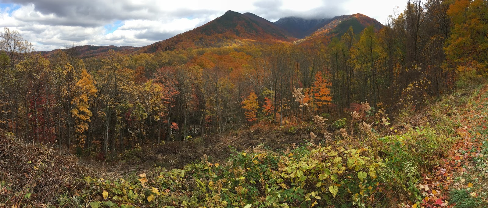
Another thing I am finding surprising here is that there are still vestiges of fall colors on the south side of the Smoky Mountains in late November. I tried to capture the beauty of sunlit fall colors on the lower foothills and ice-encrusted foliage higher up on a wooded mountainside, but my Iphone didn’t do it justice. As I was hiking up Le Conte, bundled in many layers against the cold, despite the many miles of relentless uphill, I was amused by the gentle tap-tap sounds of small bits of ice falling from the trees as the warmth of the sun caused the ice to lose purchase on the tree branches, swaying in the gentle breeze.
The morning of 11/22 I cleaned off the road grime that had accumulated on my bike’s chain and went for a ride on the one-way scenic 11-mile loop that leaves from the Cades Cove campground, hoping to hit it before the bulk of the tourists arrived. The night before, when I arrived just before sunset, there was a steady stream of cars on the route that would make for a less pleasant experience. It was still below freezing when I started the ride and there were a fair number of cars. Not fun on a not very wide road. But I enjoyed a few stretches with no cars. From May to Sept, they close the road to cars on Wed. and Sat. mornings. That would be a great time to ride it. The scenery was beautiful and there were many stops where a ¼ to ½ mile hike (or alongside the road), you could wander among wood cabins built in the 1920s and 1930s or replicas restored by the Park Service to give a feel for what the area was like when it was farmlands. There were 3 churches and cemeteries and a collection of buildings including a blacksmith shop and various barns. I opted to keep riding for the morning bike-ride loop and returned after that with my van to explore all the nooks and crannies with the rest of the cars.


The next day I drove 2/3s of the way around the loop to access the trail head for the other bald in the park – Gregory Bald, which I accessed by hiking up the ridge route. Yep, mostly trees with few views on the way up. As I got up higher I could see (and smell) that it was quite smoky. I was about 2/3 of the way up the 5.5 miles uphill distance, so I didn’t want to turn back though I wasn’t sure if there would be any views when I got to the bald. Sure enough, there was a hint of mountains, masked by thick smoke. My lungs were burning a bit as I neared the top so it probably wasn’t the healthiest of hikes I could’ve done.

I was trying to upload more photos but I'm not having any luck and it's getting late.

Today (Thanksgiving Day) I hiked a loop hike (9 miles) and then made my way from the park to the town to the NW of the park  (with slow internet but at least I'm finally connected!). From here I'm off to the highest points in Georgia and in South Carolina and then will visit my niece, her husband, and my grand-nephew and grand-niece farther south in SC.

Happy Thanksgiving all!

Friday, November 11, 2016

Pony Therapy

Before I explain pony therapy I'll catch up on Blue Ridge Parkway; the Virginia portion.  After my  hilly bike ride of the previous day (mentioned in my last post), I started out my morning a little slow but got it in gear to enjoy a great 10 or so mile hike on the Rock Castle Gorge trail. Apparently, somewhere along the route there are rock crystals that reminded folks of castle turrets; hence the trail name, but I didn't see any of the crystals. The trail started out with a long, steep descent into the gorge. Parts of the trail were narrow with exposure and blanketed in thick, slick leaves. Deep in the gorge there were more leaves remaining on the trees than in the more exposed places, where trees have lost their leaves (fall has fallen).


Once I hit the bottom of the gorge, the trail started a gentle uphill along a stream, but was still heavily wooded so not much for views. I can't quite figure out what the strange tree (or root system?) in the photo below is, but it was interesting.  The ascent got steeper and finally broke out of trees as I got closer to the top. Thanks to ladders like the one pictured below, the route included a number of cow pastures and, of course, cows.


It was such a treat to break out of the trees into the sunlight and expansive views of farmlands.


As I was getting close to the top of the hike up I came across 2 white tail deer; a 3 or 4 point buck and a doe but I didn't get very good photos.  The views from and near the top were very nice and the stroll through the open pastures in the sunshine very rewarding.


The next day I took a variety of short hikes along the Parkway, including visiting a display of historic Appalachian way of life, including a picturesque, water-wheel-driven grain mill, pictured below along with the stones used in the grain grinder.


From there I headed north toward the highest point in Virginia. I spent  election night in a Walmart parking lot, not quite reaching my destination -- Grayson Highlands State Park. I woke up at 2 am and checked election results and again at 3. When I woke up again in the light of day, I wondered if perhaps I'd dreamed my wee hours news gathering? Nope... As I was driving I fretted about what might become of our nation, but the decision is made. All we can do is hope for the best.

Once I arrived at Grayson, I selected my campsite for the next 2 nights and headed off on my hike to the top of Virginia -- Mt. Rogers. I knew there would be no view from that summit but the views on the way up to the woods were truly amazing, and the "wildlife" was very therapeutic. My concerns over election results were soon replaced with great happiness.


The scenery is quite different than what I'd been seeing but what made it totally delightful were the ponies. It used to be that cattle were grazed in the highlands to fatten them  up before they were sold. But once it became a park, the cattle were no more and the habitat became overgrown. So they introduced wild ponies as "weed eaters".  They round them up once a year for a health check and sell off a few to keep the herd size under control. They are hearty little beasts that can survive the windswept highlands year round.

t

Guess what? Ponies can't read. And they are so darned cute that when they are nuzzling around, you can't help but pet them (it also keeps them from nibbling at you).


It was fun to interact with them; they made me happy and they really add to the beautiful views of the area.


Some of the ponies had amazingly long manes. It's a wonder they can see through them.


I hiked for 3 days (40 miles) in Grayson Highlands. The first day I hiked up into the clouds to the highest point in VA. I knew there would be no view so it didn't matter that the clouds were descending. I had views on the way up but coming back down, the clouds had settled in even at the lower elevation and there was blowing snizzle (snow/drizzle). I was happy to settle into my van and turn on the heat as the wind gusted outside. The next day started out windy but the afternoon was amazing with almost no wind and no clouds. What a difference a day makes! It was so peaceful that I stayed at length at numerous highpoints to enjoy the views. It would have been a perfect night for a fire at my campsite but by the time I got back, the place that sells firewood was closed and they discourage local wood gathering. Today the winds didn't die down and high clouds were forming but there was no precipitation.

I don't like driving at night so once I finished my 14 mile hike late this afternoon I started heading back toward Blue Ridge Parkway, North Carolina and got as far as the same Walmart parking lot before it got too dark.  Tomorrow it's back to the Parkway to resume my explorations on my southward journey.