I'm back at the same RV park in Albuquerque but closer to the office. Maybe the wifit will be better and I can actually catch up? We'll see.
From Lake Mead I started making my way toward New Mexico and
since it was sorta’ on the way I zipped up to the South Rim of the Grand
Canyon. I was hoping to find a campsite and do a rim back to rim hike (down South
Kaibab up Bright Angel) but the park was packed. No campsites and it took me an
hour just to find a place to park for a day hike. I did a 10 mile hike along
the rim an got out of there. It's the 4th time I've been to the south rim. Given the crowds, I didn't see a reason to linger but at least I got a good hike in and peered into the canyon (aka "The Big Ditch").


I made an appointment for an oil change in Flagstaff and headed there the next day. Once I got that done I stopped by a local outdoor shop for some “expert advice”. For weeks I’d been eyeing the high point in Arizona (Humphreys Peak). It’s 12,633’ tall so you can see it from MANY miles away. It was still buried in snow so I was assuming I wouldn’t be getting to the top of it anytime soon. But the guy at the outdoor shop assured me “As long as you have microspikes and hiking poles, you’ll be fine.” Since that’s all I had to get to the top of Mt. Adams last August I figured I’d go for it.


I made an appointment for an oil change in Flagstaff and headed there the next day. Once I got that done I stopped by a local outdoor shop for some “expert advice”. For weeks I’d been eyeing the high point in Arizona (Humphreys Peak). It’s 12,633’ tall so you can see it from MANY miles away. It was still buried in snow so I was assuming I wouldn’t be getting to the top of it anytime soon. But the guy at the outdoor shop assured me “As long as you have microspikes and hiking poles, you’ll be fine.” Since that’s all I had to get to the top of Mt. Adams last August I figured I’d go for it.

It's probably not a good sign of things to come when the trail head starts at a ski resort and they are actually skiing (although don't ask me why -- just this small portion of snow was groomed -- maybe it was a private party???).
Bad idea. Whereas the
route up Mt. Adams didn’t require any challenging navigation, Humphreys
certainly did. Just following footsteps in the snow in the dense trees wasn’t
the answer; folks were going everywhere. I had an app that let me see where I
was relative to the trail but I didn’t dare keep the phone in my hand as I was
ascending the steep slope in the snow. If I had dropped it, it would have taken
a wild slide down the snowy slope and I’d never see it again.
 |
| My view from as high as I got on the highest peak in AZ. This photo doesn't really show how steep it is. |

It was slow going; after several hours of
struggling up the steep slope to 10,811’ it became apparent I wasn’t going to
make it to the top and back to my van in the daylight so I headed down and
route finding wasn’t any easier on the descent. That afternoon, someone posted
a GPS track on the app I’m using “All Trails”; they wandered even worse than I
did in attempting to find a route and didn’t get as far up the mountain. That made me feel ever so slightly better... I only had a short drive from there to where I was boondocking for the night -- down a forest service road.
The
next day I took in 3 National Monuments very close to Flagstaff – Walnut Creek,
Sunset Crater Volcano, and Wupatki (another area of ancient pueblos). I was able to see all 3 in a day and hike all
the trails they had available.

Walnut Creek was less than exciting. A loop trail to see a few crude structures under rock ledges. Had it not been nearby, I wouldn't have gone.

Sunset Crater Volcano had a few trails and a good view of Humphreys Peak so I could contemplate the previous day's 'folly'.

 |
| It was amazing that these yellow flowers could grow on ground covered with lava debris. They must have very long roots. That's Humphreys in the background; part of the San Francisco Mountains. |

From there it was on to Wupatki, included in a loop of scenic driving.


 |
| Before too much longer (???) I'll run out of ancient crumbling walls to visit... |


After that I made a long drive (the scenic route rather than I40) to New Mexico and took in a couple more National Monuments -- El Morro and El Malpais (The Badlands; so named due to the vast expanse of volcanic rock, which made it difficult to cross the area).

At El Morro heading toward inscription rock.


It was the year-round water at the base of these rocks that drew travelers over time. A pueblo was built atop the rocks and the ancient puebloans left pictographs on the rocks along the base, as did historic travelers on military and exploratory journeys; earning the title "Inscription Rock".


In El Malpais I hiked to La Ventana (the window):
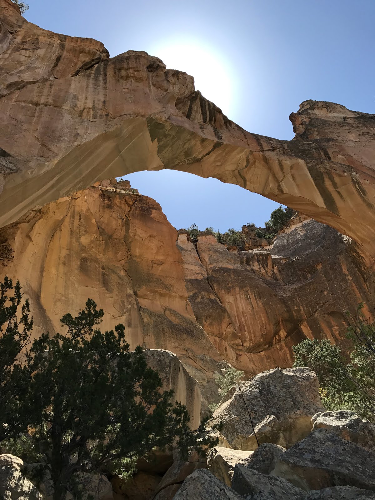
And along a trail on a bluff called "The Narrows" overlooking a vast expanse of volcanic rock that was a curse for historic travelers trying to get across it; earning the name El Malpais (The Badlands).
 |
| That's all lava below the bluff. |
 |
| La Ventana from above. |
 |
| A variety of types of lava flow can be seen along "Lave Falls" trail. |


The last stop in El Malpais was the Sandstone Bluff Overlook.


