Saturday, January 21, 2017

New Orleans and into Texas


Even though I have 3 bars where I’m parked tonight (on a dead-end road parallel to I-10 near a gate to what must be a very large ranch in Texas), I have no internet. Verizon apparently doesn’t play well with others, so the non-Verizon towers I’ve been hitting must be giving me very low priority. I lost my GPS navigation that I was using with my cell phone to try to avoid Interstate Freeway driving. I don’t have a Texas map and I’ve been driving on the margins of 4 different pages of maps in my road atlas, mostly on roads that aren’t showing up on any of them. I think I may have done a large circle in the last hour of driving ‘off the grid’, even though for each new secondary highway I encountered, I continued to take the west direction. Oh well, tomorrow I’ll hop on the interstate freeway briefly and exit onto a road I see on my map to send me toward my ultimate destination – Big Bend National Park, on the TX/MX border along the Rio Grande.

As for driving here, Texans are apparently in a hurry. Even the secondary highways have speed limits of 75 and I-10 is 80mph. I don’t like driving that fast, and dealing with traffic lights on 65mph roads is not at all fun.

Today (1/19) was a day of endless driving (9 hours) across central Texas. I don’t like to spend all day driving, but I’ve grown tired of flatlands and high humidity. The Florida beaches were nice, and paddling the swamps of Georgia and Florida was great fun. Swamps are such a new habitat for me; I was enchanted by the draping Spanish Moss and the large cypress trees. Day before yesterday I camped at a campground in Louisiana that had a canoe trail but it was only about 2 hours of paddling; not enough to entice me to deploy my inflatable kayak since it didn’t look near as magical as the swamps of FL and GA.  If it had still been inflated and was still on my roof, I’d definitely have done the paddle but I’d dried it out and put it away awhile back.

The pond near my campsite, with canals leaving from there. But too far from my campsite to carry my kayak if I'd inflated it.
Maybe I should have sought out a Louisiana Bayou and deployed my kayak to see if it differed from those in FL and GA, but my hiking boots and hiking poles (i.e., essential paraphernalia when I hike in terrain) are whimpering for attention. As I check back in the brief notes I’ve been keeping of daily activities, I see that the last time I had need of them was on 11/27! EEK! Just as I discovered when I was touring the Midwest, alas, I am not meant to be a flatlander. As John Muir once said “The mountains are calling and I go.” Hence the mega-drive day.

Just west of Austin it was evident I’d driven out of the widespread heavy rains that plagued a wide swath of TX yesterday and today (with floods in Houston), and I’d escaped the high humidity. At 8pm it’s 74 and 54% humidity – MUCH better than the 80-95% humidity I’ve been dealing with for the last 6+ weeks. 

Tomorrow may be another mega-drive day, but that would get me to Big Bend late on a Friday night (P.S. Wrong! I arrived at 4pm). I might be smarter to drive a half day and explore along the Rio Grande, getting to Big Bend on Sunday afternoon instead, hoping some folks will be leaving after the weekend. About half the campsites are available to reserve ahead and the availability was spotty (a day or 2 here and there for any single site) when I checked last night. The others are first come first served. I am hoping to land for at least a week in the campground (Chisos Basin) that lets you access the mountain hiking, and will probably spend 2 weeks exploring the big park. Time will tell whether that exploration begins early in the weekend or late. As always, I’ll play it by ear (PIBE it) and figure it out as I go tomorrow. (P.S. I went for it and lucked out, getting a site exactly where I wanted to be.)

But I’m getting ahead of myself. My last post ended with my meeting with a fellow full-timer who has a van like mine. From there I made my way toward New Orleans along the gulf coast. After leaving FL, it didn’t take long to pass through the tiny sections of Alabama and Mississippi. I spent a night in a parking lot across from a casino in Biloxi, MS and got to the RV park along a canal on the outskirts of New Orleans just after noon on Friday of the Martin Luther King 3-day weekend.
It’s the most I’ve paid to park my rig, but the location was handy and secure and they offered multiple shuttles a day to/from the French Quarter (18 minutes away) for $6RT. 
Not a whole lot of space between sites, but I wasn't there for the view. My rig is in the middle of the photo.
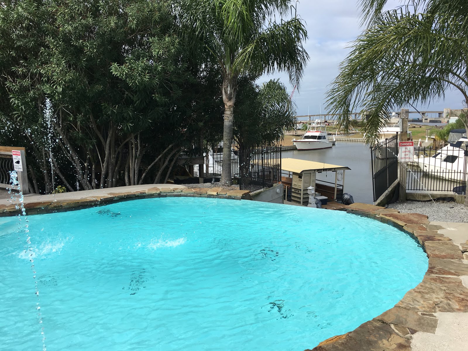
It was an RV park and Marina, with pool, hot tub and restaurant/bar with live music.
I got settled into my site, grabbed a shower, and took the 4pm shuttle to the French Quarter. The drop off site was 3 blocks from Bourbon Street and a block from Jackson square, which was filled with street musicians, street performers, artists, and palm and tarot-card readers.  It was a little overwhelming at first, but I quickly settled into people watching and attempting to capture the ‘essence’ of New Orleans with my iPhone camera. I’m not sure I’ve done it justice, but it was fun trying.
There were some really great musicians and street performers (and some so-so performers) spread throughout the French Quarter. 
These guys were great! Exactly the kind of music I expected to hear in New Orleans.
I wound up buying some CDs from this musician; him solo and with his band.
There was also an impressive assortment of fascinating characters, not all of them young, earning their living by performing on the street. 


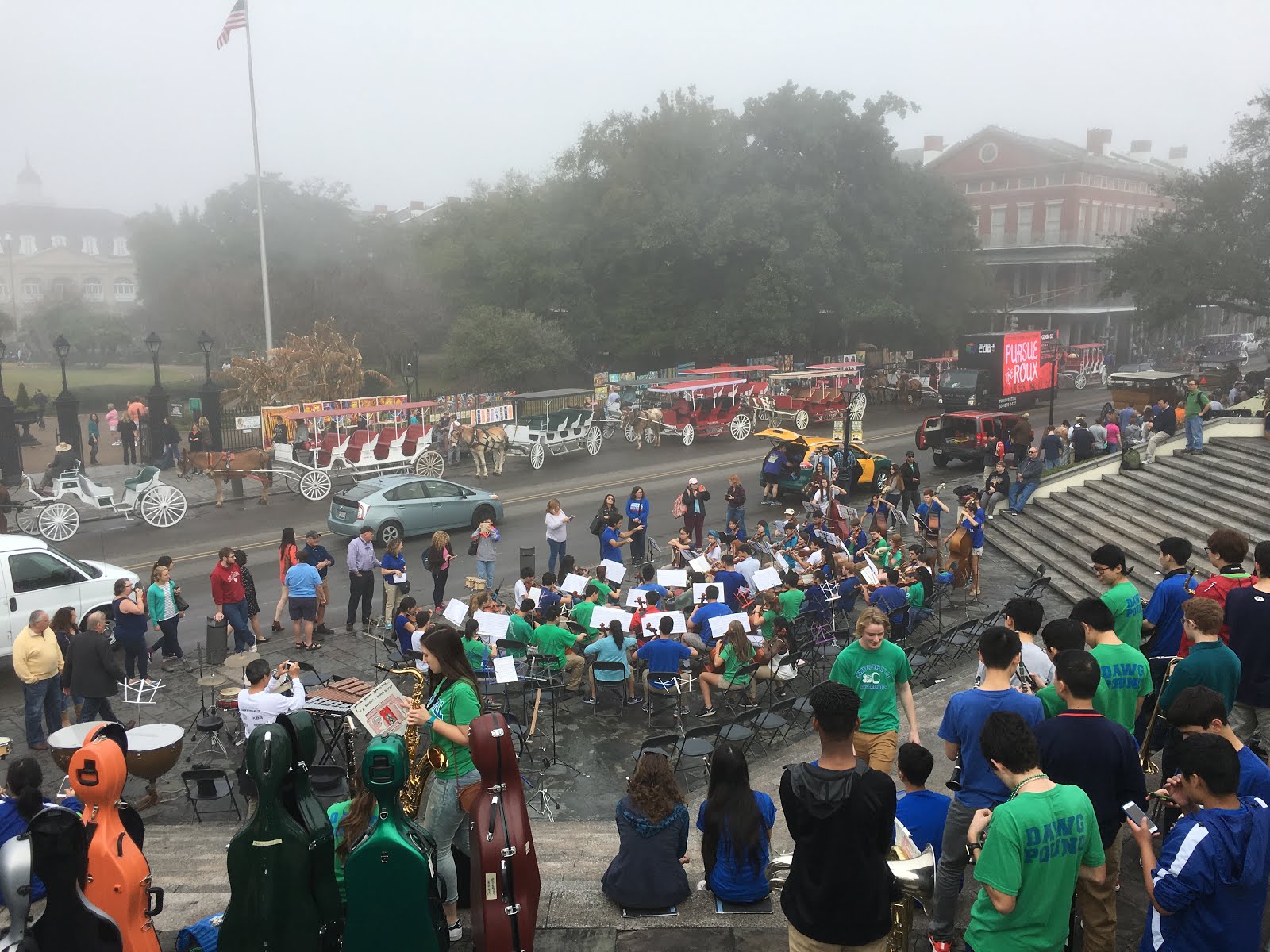
I saw a number of parades of sorts. There was a “secondary parade”, with a police escort and (of course) a band. I’m not sure what the occasion was for that one. 
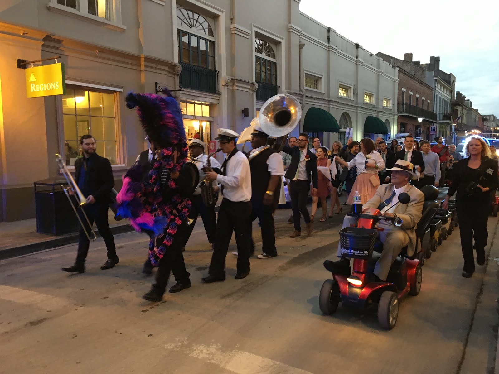
There was a wedding party – no police escort, but led by a band as they paraded in the street and later down the halls of a posh hotel where I assume the reception was held. 

The bride and groom are just behind the band, with umbrellas.

Then there was the unofficial ‘parade’ for “Pardi Gras”. No band to lead it, but plenty of partying tourists, of all ages, to join in.


 I took a ghost tour my first evening, and a hop-on/hop-off bus tour around town the next day, getting off in the Garden District where the finest, historic homes are. 
Thar be ghosts here.
My tour guide. He lives in the French Quarter; theater is his passion and the French Quarter his stage.
This house, in the Garden District, belongs to Sandra Bullock.

I visited the Audobon Aquarium and surround-sound/view theater (where I watched an interesting documentary about Hurricane Katrina and the effects of the continuing loss of wetlands). 

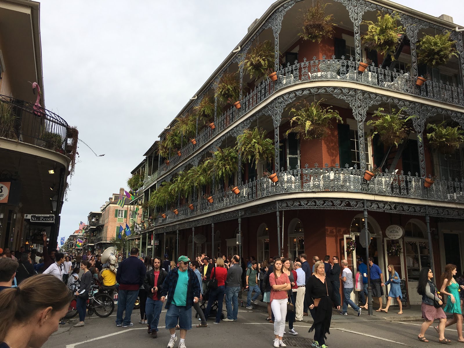
Amazing architecture in the French Quarter.
I walked along Bourbon Street both evenings I was there, and during the day as well. That’s definitely a wild street, primarily aimed at attracting tourists that are there to party. 

The music I head in the bars along Bourbon street was more along the lines of pop music; not the traditional jazz or blues I’d expected. I’m told that the locals go to Frenchman Street and go into clubs for a fine dinner and quality entertainment. It was far enough away from where my shuttle pick up was (at 8pm) that I didn’t take in the more tasteful entertainment. Except for that omission, in the 20 hours of wandering I did around New Orleans on 3 different days, I got a fairly good sampling of the happenings.

I headed West out of New Orleans and went for a tour of a plantation (Laura’s) where the slave existence was also well represented. It was interesting to learn that the plantation had been primarily run by 2 generations of women – a wife took the lead when her husband passed and when her sons died, the plantation was run by the surviving daughter (Laura) before it was sold and became a share-cropping site when the slaves were "freed". 


The many phases of Laura's life -- the daughter who inherited the plantation.
The pantry of the main house.
This plantation had a huge number of slaves. This is a small sampling of the 'worth' of some of their "property".


Slave houses.
Many people lived in tiny spaces.
The last share cropping ended in 1977. Shocking to learn that it carried on for so long. The folks that did the share cropping received very little compensation for the crops they sold to the land owner; they were allowed to keep just enough of their crops to survive and had to buy all their goods (at exorbitant prices) from the folks they sold their crops to. The young woman who gave the tour was passionate about the subject and gave the best tour I’ve had the pleasure of experiencing. If all their guides are as enthusiastic and well informed as she was, it’s no wonder it was named the number 1 Louisiana tourist experience.

That catches me up again. If I get a chance to post this and some photos before I head to Big Bend, I will. It’s hard to say how much if any cell coverage I’ll have in Big Bend. It’s a long way from any city. The only folks driving down the long road to the park are those that are there to explore the park, so maybe there won’t be anything but payphones and land lines there. But the park looks worthy of exploring, with plenty of hiking opportunities that will actually include elevation gain and summit views! :0)


I am posting this from Big Bend. Although I have no cell coverage from where I’m camped (Chisos Basin, for at least 5 nights), a 0.4 mile hike up the hill to a lodge gives me access to wireless so I treated myself to dinner and will get this posted.  I am a very happy camper to be back in the land of mountain hiking. I hiked 11 miles to Emory Peak – the highest point in the park. But more about that later…

Wednesday, January 11, 2017

Spontaneity


The beginning of a new year and the beginning of my 5th month of life on the road (9,600 miles later) seem like a good time for reflections. With my current lifestyle, spontaneity is a good thing to embrace.  You never know what the day will bring. Ten days ago I left in the morning, planning to drive to a campground in a specific area, but I have yet to get there. It looks like I might not get there at all. But that’s OK. There are so many  things to see and do!

In route to my intended destination that day, I decided to head in a different direction, for a shorter drive. Where I wound up that night was not that exciting, though I did get a good bike ride in after I parked.  

In my wandering the next day I found a great place to stay at Ochlokenee River State Park. There were nice places to hike; with scenic views along a river and through the woods, and plentiful wildlife, including pretty snakes,  white squirrels, plentiful 'normal' deer, and a white (piebald) deer. 

This little guy was stomping his foot, initially unhappy with my presence, but then he went back to foraging.
The ranger told me there's a genetic mutation and a deer like this is taken during during hunts every now and then. This is the only one they are aware of at the moment. I took this photo with one of those tiny lenses that you clip onto your smart phone. Don't believe the claim ads make, that professional photographers are using them instead of 'real' cameras (and they show you the super sharp images the lens supposedly takes). It's hard to get a well-focused photo. But you can get a closer view of what you're trying to photograph that's far away, and it is a sharper image than zooming in with your smart phone. 

My campsite was along the river which made it easy to launch my kayak from my “backyard” to paddle a canoe trail the next day.

You can see my van in the woods to the right of the bench. Great campsite!
Sunset from behind my campsite.


A gorgeous view along my morning stroll, with my coffee in hand.

That night a friend messaged me to suggest I meet up with a friend of his that was a manager of a Wildlife Refuge. It was 2.5 hours south of me rather than in the westward direction I was heading. Meanwhile I received a request to meet up with another woman in a westward direction who was also living full time in a van like mine and exploring – she’s been at it 16 months.

The southward suggestion was 7.5 hours drive from where I needed to be 5 days later to see a hand specialist. In mid-November I woke up with a finger bent at an unnatural angle; apparently a tendon injury. I’d been rock scrambling the day before (in the land of the fat ponies) but I didn’t remember hurting myself… I Googled it and learned it was Mallet Finger, that needed to be splinted for 4-6 weeks. I bought an over the counter splint but it didn’t do the trick.  Time to seek professional help.

Confused over the dilemma of whether to head south before I continued westward, I went to bed without a plan. I woke up in the morning with the affirmation that I could do it all. I contacted the other full-timer to tell her I’d meet her at a campground 2.5 hours drive from my hand appointment the night before that appointment. Then I contacted the wildlife refuge manager to see about visiting him. So much for all that internet search about his refuge. He was going to be gone until the day before my appointment. So I launched plan B.

I drove north thinking I’d need to drive 45 minutes to a place to get propane but I found it just 20 minutes away, near a place I’d wanted to explore. I stopped to do a major grocery shopping and kept running into the same white-haired woman in almost every row I ventured down. We were apparently shopping for similar items. On our fourth encounter, she (Marsha) said “I haven’t seen you in here before. Are you associated with the RV out there?” At my encouragement, she happily made suggestions of places I should see and things I should do. Then she asked “Where are you staying tonight?” I told her I didn’t know yet. She invited me to dinner and to park at their place. Her husband, Karl, caught up to us about then and she told him I’d be joining them that evening.

Marsha sent me off to explore the wildlife refuge she volunteered at – a place where you could hike or ride a bike on an extensive series of dikes along multiple canals, filled with migrating birds. I had a great time exploring St. Marks National Wildlife Refuge that afternoon.

St. Marks National Wildlife Refuge.


 I showed up at Marsha and Karl's place just before dark, as instructed. And a gorgeous place it was.
My campsite at Marsha and Karl's.


Marsha is 84 and Karl is 88. Retired school teachers; she taught elementary students and he was a music professor at Florida State University. They are mentally sharp and physically spry. We had a wonderful evening. Who knew, in Trump country, that I’d find people that shared my political views? They were a bit concerned about me too, since they were aware of Alaska’s political tendencies. They cut to the chase right away when they said they hoped I didn’t mind, but they watch PBS News Hour every night at that time. Our conversations around the news made it clear we were like minded.

It was a delightful evening and the next morning after breakfast I headed off on another of Marsha’s suggested activities.  I launched my kayak and paddled up river for nearly 4 miles on a quest to see manatees. There were none to be found. Oh well… I saw lots of turtles and birds. It was a scenic paddle and the paddle down river was much faster. I headed from there to a nearby state park that also claimed to have manatees but I failed again in my quest. Oh well…


The next day I headed back to St Marks in a “Florida state of mind”. It was unusually cold at 38 degrees, with 20 mph winds, gusting to 30. It was heavy overcast with humidity of 92%.  Brrrr!!!! I was resigning myself to indoor activities; I hadn’t entered the Visitor’s Center when I’d been there before. There was also a kid’s aquarium in the area, I could go there too. But the mantra “There’s no such thing as bad weather, only bad clothes” popped into my head. Of course (!!) I had multiple layers of cold weather gear and a wind-protection layer! Phew! I snapped out of that Florida mindset and enjoyed a 16-mile hike that day and the clouds went away and winds died down. My hike was long enough, I didn’t have time for the visitor’s center or aquarium, but that’s OK. I can’t possibly do it all.


I’m still in Florida, exploring some of the barrier islands along the Gulf of Mexico. After settling into my campsite on St. George Island, I headed out on my bike to ride from one end of the island to the other and back. About 11 miles of my 31-mile ride was into a wicked head wind and the last 10 miles was a dirt road, some of it was deep sand. It was very tempting to not do that last 10 miles (half into the wind), since I passed my camp ground before I started down that dirt road. But you know how it goes; set out to DO something and pure stubbornness keeps me going. Happily, the last 5 miles back to camp was a tail wind.
The far end of St. George Island at the end of a gravel road, and (presumably) a casualty of Hurricane Mathew.
I took a long hike before I left the campground the next morning to make my rendezvous with the full-timer. She’s a white-haired 70-year-old, and oh the fun tales she (Chrys) had to tell about how many times she’s been adopted during her solo travels. Memories of her tales were fueled by showing me beautiful water-color paintings she’d made in small sketch books during her travels. I guess when you have white hair and more wrinkles than I have, you get adopted even more. We both agreed that we love our vans and love life on the road.

The next morning I went for a speedy walk and jog, hopped in the shower, said goodbye to Chrys and headed off to see the hand doctor. Sure enough, my web-search diagnosis of Mallet Finger was correct. And yes, it needed to be splinted (which I did faithfully for 2 months to no avail). So now I’m going to get a custom-fitted splint, specific for mallet finger. I’m to wear it full-time me for a month, and then for another month at night and when I do strenuous things. I’m dubious about the success, but it is true that my modified over-the-counter splint didn’t quite keep my finger straight. So maybe it will work. I doubt I’ll be back to this hand doctor in 8 weeks for a recheck. I’ll find another one wherever I’m at then.

This has gotten quite long so I’ll call it good for now.   I’m in the northwestern corner of Florida camped on yet another long, skinny barrier island at Gulf Islands National Seashore Park. I explored the fort and went for a bike ride today. Tomorrow, once I get my splint from the physical therapist, I’ll be leaving Florida and continuing westward. I may get brave and visit New Orleans if I can manage the traffic and figure out how to keep my van safe. Time will tell...

Monday, January 2, 2017

Florida

Happy New Year to you all.  I hope you had a great holiday season and will have a great 2017.

Greetings from Florida, where I spent Christmas and saw in the New Year.

After the adventures (on Cumberland Island) that I shared in my last post, I headed south in the direction of where I was going to get my broken van window replaced. As I was hiking at Juniper Springs campground, I heard some scrambling in the trees -- a bobcat chasing after a squirrel. The squirrel took a flying leap into the next tree and the cat was distracted by my presence and started a stare down with me. After a while it got more comfortable, hanging a leg down one side of the branch. As I was watching the cat, the squirrel leaped back into the tree (death wish?) and came along the branch to within 6' of the cat's tail. I figured I had already saved the squirrel's life twice. The first time I passed this tree, earlier in my hike, 2 bobcats ran down the tree at my approach and ran away. I 'thought' it was bob cats but didn't get a very good look. On my way back past the tree one of the cats had returned to try to resume the hunt. I watched for a while longer to see what would happen on round 3 of the battle, but nothing did while I was watching since the cat was distracted by me. So I finished my hike, checking out the beautiful springs, and headed to my next destination.


The water in Juniper Springs was very clear and there were a few areas where water was bubbling up from below, where an extensive karst cave system exists.

From Juniper Springs I headed south to SW corner of Lake Okechobee, where Sherry and Gary spend their winters -- the folks that first put this idea of life on the road into my head, 6 or so years ago during one of my hiking trips in Utah. They spent 2 years exploring, equipped with an RV trailer, bikes, and kayaks. We had a great visit for 2 days; I went biking with Gary and birding with Sherry and we shared many fun stories. Somehow I failed to take pictures of them, but here's a picture of the Christmas parade of decorated golf carts, as they made their way through the RV resort, collecting donations from the residents to donate locally to families in need.


My next stop was Savannah Recreation Area where my campsite was alongside a canal system. I deployed my inflatable kayak to explore, and got a little bike riding too. The sandhill cranes were quite bold. When I first saw them I wondered if they were tame or had their wings clipped, but they could fly. Other pairs of cranes came and went, along with a plethora of other long-legged birds (egrets, ibis, and herons).  Only the cranes (presumably the same pair?) strolled through the campsite, perched on picnic tables, and foraged in the mowed grass of the campground, oblivious of the people. When they were pecking aggressively at acorns, within 5' of my feet, I decided to leave since my bare toes in my sandals might have looked similar to the small, elongated acorns. 

I'm not sure what these eggs are, but globs of them were adorning grass blades along the canal system.

After getting my van's broken window replaced, I headed north to the Daytona Beach area for my "Alaska fix".  I met up with Marc, Geoff, and Tango Larson, and their families for Christmas. It's been many decades since I've been a part of a 4-generation family gathering. I spent just over a week there -- a record-long stay for me since I started my wandering 4 months ago. Thanks to the Larson and Bradley clans for making me feel like part of the family. 

We didn't see manatees (they'd headed for the warm springs already), but we did see dolphins on our kayak outing, including some spinner dolphins that treated us to aerial acrobatic displays.
After leaving the family gatherings, I departed the Atlantic coast of Florida and started my westward migration. Enough of this heat and mugginess (though it did drop to 39 degrees one night).
Sunset on "Ocean Pond" (freshwater) in Osceaola National Forest. I camped here on New Year's Eve and night, and enjoyed a 6 mile hike and 19 mile bike ride around the lake.

I'm now on the Gulf of Mexico side of Florida. Thankfully (!!) the heavy rain and thunderstorms, and potential for tornadoes that are happening tonight, are a short ways to the west of where I am tonight as I write this.

I haven't figured out my route west, or my time frame. It will be partially determined by when/where I can get some minor medical things taken care of.  One of the challenges of life on the road -- figuring out what providers are in my insurance network that are along my way. But once I get those details taken care of (and my van need some doctoring of its propane heating system too), I'll be able to focus solely on fun again. Although I usually try to avoid big cities, I've never been to New Orleans and it's 'on my way'. So I might get brave and tackle that as I make my way toward Texas and Big Bend National Park to get back to more ambitious hiking than I'm finding in Florida. After that, I'll head to New Mexico and Arizona -- there are several sets of friends I hope to catch up with in AZ. Hopefully I'll find good places to land for several weeks at a time for good hiking and biking.