Sooo… Hard to say when I’ll get to post this. Maybe
tomorrow? I’m due for a night at an RV park to dump my tanks, do some laundry,
and take a long shower. Hopefully they’ll have decent wireless? As I write this I’m in Natural Bridges
National Monument in Utah. Tomorrow, after a couple of short hikes here I’ll
head north and cross the north end of Lake Powell. If there’s a good RV park at
the north end, at Hite Marina, maybe I’ll stop there but I’m guessing by the
time I get there they’ll be full so it’ll be on to Hanksville. From the map
location, it doesn’t seem to offer anything appealing, other than a town for
groceries and rejuvenation (i.e., aforementioned chores) before I head on to
Capitol Reef National Park.
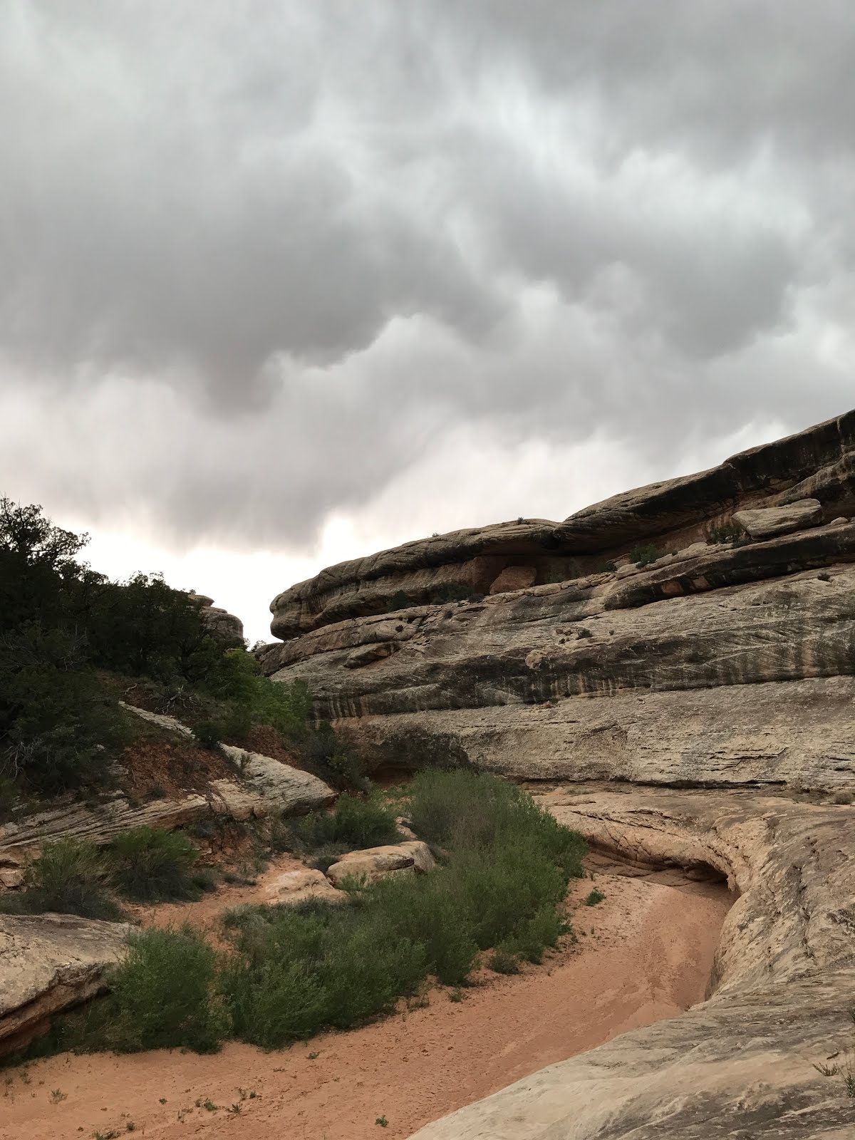
There’s been some weird weather yesterday and today. This
evening it was 68 degrees but the thunder (and presumably lightning) was
followed by being pelted with small snowballs. How is that even possible? If
there are any weather gurus out there please enlighten me.

At least this time I was in my van for this weird weather. For
about 1/3 of my hike the day before I had fun with high winds kicking up dust in the
canyon, deep rumbling thunder and distant lightning. Then the thunder got
louder and lightning brighter. I was counting 5 seconds between lightning and
thunder. In ‘the old days’ that meant it was 5 miles away but I remembered
reading more recently that that wasn’t true but I couldn’t remember what WAS
true. Initially when the thunder began I was deep in the canyon (canyon walls
were at least 200’ above me), which seemed pretty safe. But as I continued my
loop hike, the canyon was getting shallower and I know that the worst place to
be when there is lightning nearby is just under the lip of a ridge. I continued
on my hike thinking, ‘when your number is up, your number is up’, and laughing
at myself for such thoughts. I laughed at myself again when I sent a preset
message from my InReach DeLorme that sends a GPS location and shows the trail
I’m hiking on, wondering if this would be the last anyone heard from me before
I fried. The things you can think of on a long, solo hike.
As I neared the head
of the canyon and was getting close under the lip of the canyon the thunder and
lightning had stopped. It turned out it wasn’t that far away after all. As I
was driving out, about 2 miles from the end of the canyon, there was a tree
smoking and occasionally showing flickering flames, that had been hit by
lightning. There was a ranger watching it; it was quite windy and she was
waiting for BLM to show up to extinguish the tree lest it should spread through
the park.
 You can see the smoking tree to the right of the dirt patch. Too bad my photo didn't catch one of the times when you could see flames in the tree. Kinda' makes you wonder why that tree got hit? It's certainly not the tallest around. It's number must've been up... Today as I passed by I could
see that the tree had been chopped to bits. That’s as close as I ever want to
be to a lightning strike (several miles and at least an hour away).
You can see the smoking tree to the right of the dirt patch. Too bad my photo didn't catch one of the times when you could see flames in the tree. Kinda' makes you wonder why that tree got hit? It's certainly not the tallest around. It's number must've been up... Today as I passed by I could
see that the tree had been chopped to bits. That’s as close as I ever want to
be to a lightning strike (several miles and at least an hour away).
But I’m getting ahead of myself. It’s about time that I post
another photo of the map I’ve been marking my journey on.

If you can zoom in you’ll see that things got a little crazy
once I hit Arizona. I’ve been zigzagging across that state to Utah, New Mexico,
and back to Utah. Perhaps not the most efficient path but it’s how life goes
when I make it up as I go along and weather keeps throwing in some wrinkles.
I spent 2 nights in Albuquerque to get some RV work done
(too bad they didn’t manage to fix my faulty black tank sensor – umphf!). I
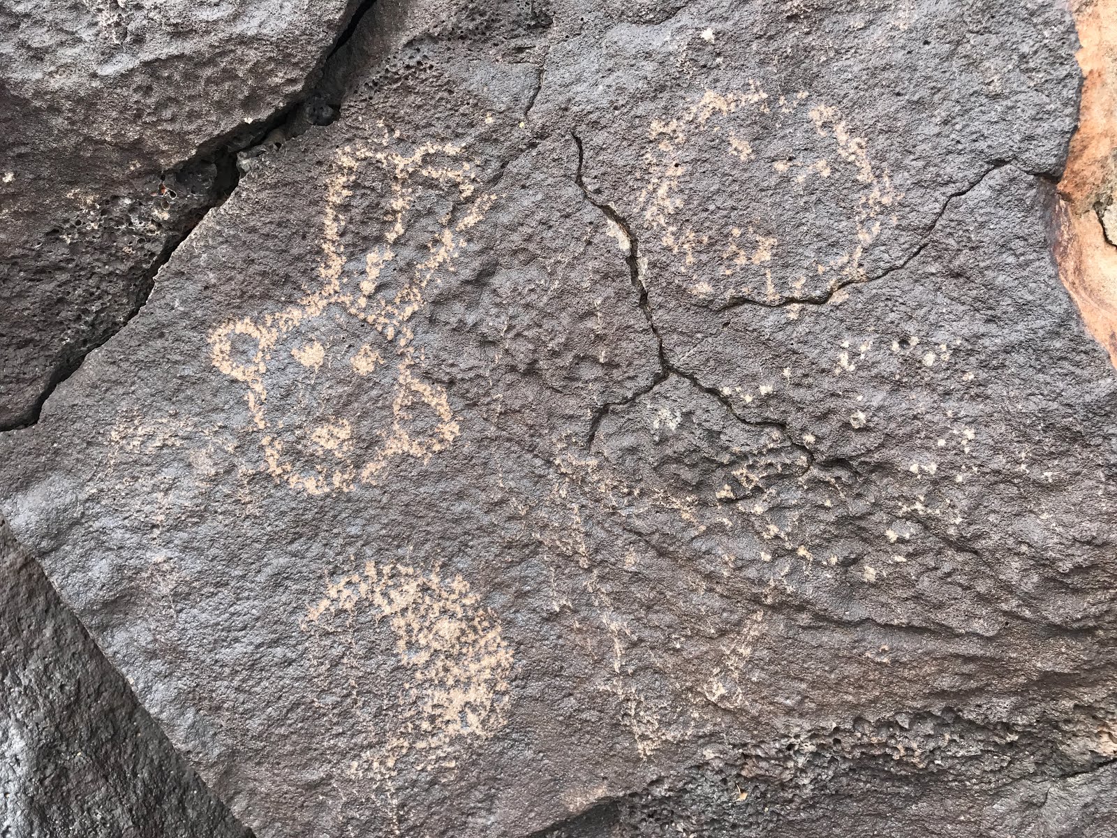
also toured all 3 sites of Petroglyphs National Monument (NM). Somehow it wasn’t
as magical as the Three Rivers Petroglyphs NM that was out in the middle of
nowhere. This is in the suburbs so you park in neighborhoods or behind a quick
lube and there are signs warning you not to leave valuables in your vehicle
(yeah, fat chance I have any way not to do that). Fortunately no one decided to
break into my vehicle. Some of the petroglyphs were hard to see because the
rocks were wet from rain but I’ll post a few pics.


 |
This was my favorite. These Kopapellis look like they are having a great jam session. |


OOPS! Did I say a "few" pics? I got carried away...
OK, now we're going back to Utah. I wasn’t going to post photos of my 1 ½ days of hiking in
Hovenweep, figuring folks are probably getting tired of seeing photos of
partial walls of Ancient Puebloan structures. It’s more interesting to find
them on hikes that are off the main stream; they tend to be better preserved
and it feels more like a discovery than following the self-guided trail
explanations of what I’m looking at. But maybe I’ll post a couple pics from
there.
 |
| Sunset from just behind my campsite at Hovenweep. The coyotes must've been impressed too. Just as the colors started getting vivid two packs started singing from two different directions. |
 |
| This structure is built on a rock and tilts at a very sharp angle. Surely it must've tilted *after* (??) they built it? |
 |
This is a Collared Lizard. They are usually quite shy and can run very fast (you can hear their feet 'thundering' as they race away), but this guy was enjoying sunning from his elevated perch and tolerated my camera in his face for quite a while. Free-range horses on the road side on my way to Hovenweep, getting rambunctious. 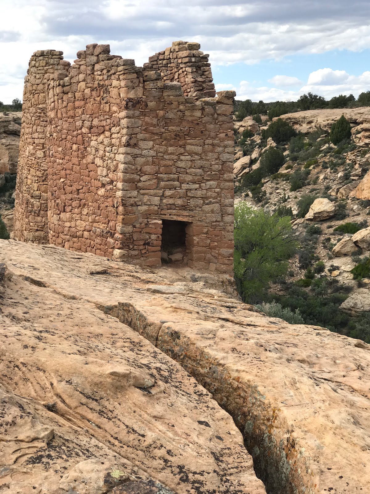  Square Tower and Hovenweep Castle (Sleeping Ute Mountain in the background).  Ancient roof beam at Holly Ruins  They used the configuration of the rock to create the path to this structure built to fit on top of the rock.  
After leaving there I made a stop in the town of Blanding
for groceries and to dump/fill my tanks and then I headed for Grand Gulch
Primitive Area. Grand Gulch is one of the canyons associated with Cedar Mesa in
the Glen Canyon region. It’s becoming a backpacking destination and many of the
trail heads can be accessed without a 4WD unlike so many other areas in UT. I
parked at the Mule Canyon trailhead and was going to hike in but decided to
head for the Kane Gulch Ranger Station to buy a map and get some suggestions
for hikes and dispersed camping. As it turned out, they’d sold their last map
earlier that day and said I should come back the next day at 10 to buy one. I
got some hiking suggestions, including one across the street that would get me
down Kane Gulch to the junction with Grand Gulch and a short ways into the
Grand with my 3pm start and sunset not until just after 8. I got back to my van
at 7:30 to give me some time to drive farther down the road and up a dirt road
to find some camping. They’d just graded the road and it was soft, deepish, red
dirt. I was a bit concerned about getting stuck when the place I found to pull
off for camping had been graded and they left about 5” of very soft soil. But I
managed to get in and out without any problems.
  My campsite at the Bullet Canyon trail head. 
The next morning, I headed to Bullet Canyon Trail head (1.1
miles down a dirt road). I was happy that I could camp at the trail head so I
got my van positioned for a comfy night and took off on a 16.22-mile hike. The
temperature was in the 80s and there were places without a whiff of a breeze.
That heat really saps my strengths and lowers my hiking speed and efficiency.
There were a few places where I had to make some big steps up and use friction
to go up and down some slickrock sections but overall there wasn’t more than a
300’ variance up and down for the full length of the hike. But due to the heat
I felt far more tired at the end of that 16+ mile hike than I had after my 25+
mile hike with 3700’ elevation gain in Bandelier in temperatures in the 50s. I
got back to my van at 7:30 and fired up the hot water heater for a quick shower
to clean up and hopefully revive a bit. I accomplished the first but not 2nd
of those 2 goals. I only needed enough energy to change my sheets (clean body
clean sheets :0) ) and get some dinner.

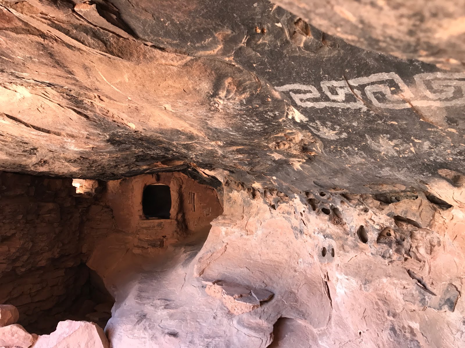
The view from a distance of "Perfect Kiva" (above with pictographs) and "Jail House Ruins".

I had never seen a window structure like this before.

Or branches packed into the walls but there are plenty of trees in the area and branches are far lighter than rocks to haul up to these high sites to use as building materials.
The next day I, once again, parked at the Mule Canyon
trailhead. It was only a few hundred yards and a short, steep hill down a
red-dirt road. There are signs everywhere in this area that warn that roads are
impassible when wet; even for 4WD. As I sat at the trail head, contemplating
the dark clouds in the sky, the only forecast I could come up with was for
quite a few miles away and it wasn’t supposed to rain until the evening. But I
knew it wouldn’t take much rain at all and I wouldn’t get up that hill. So,
once again, I didn’t hike down that trail. Instead, I headed to Natural Bridges
National Monument (and it rained lightly on the way). It has a tiny campground
that fills up early. Just before 10 a.m. there were only 2 sites left so I
snagged one of them and parked my van on a paved campsite.
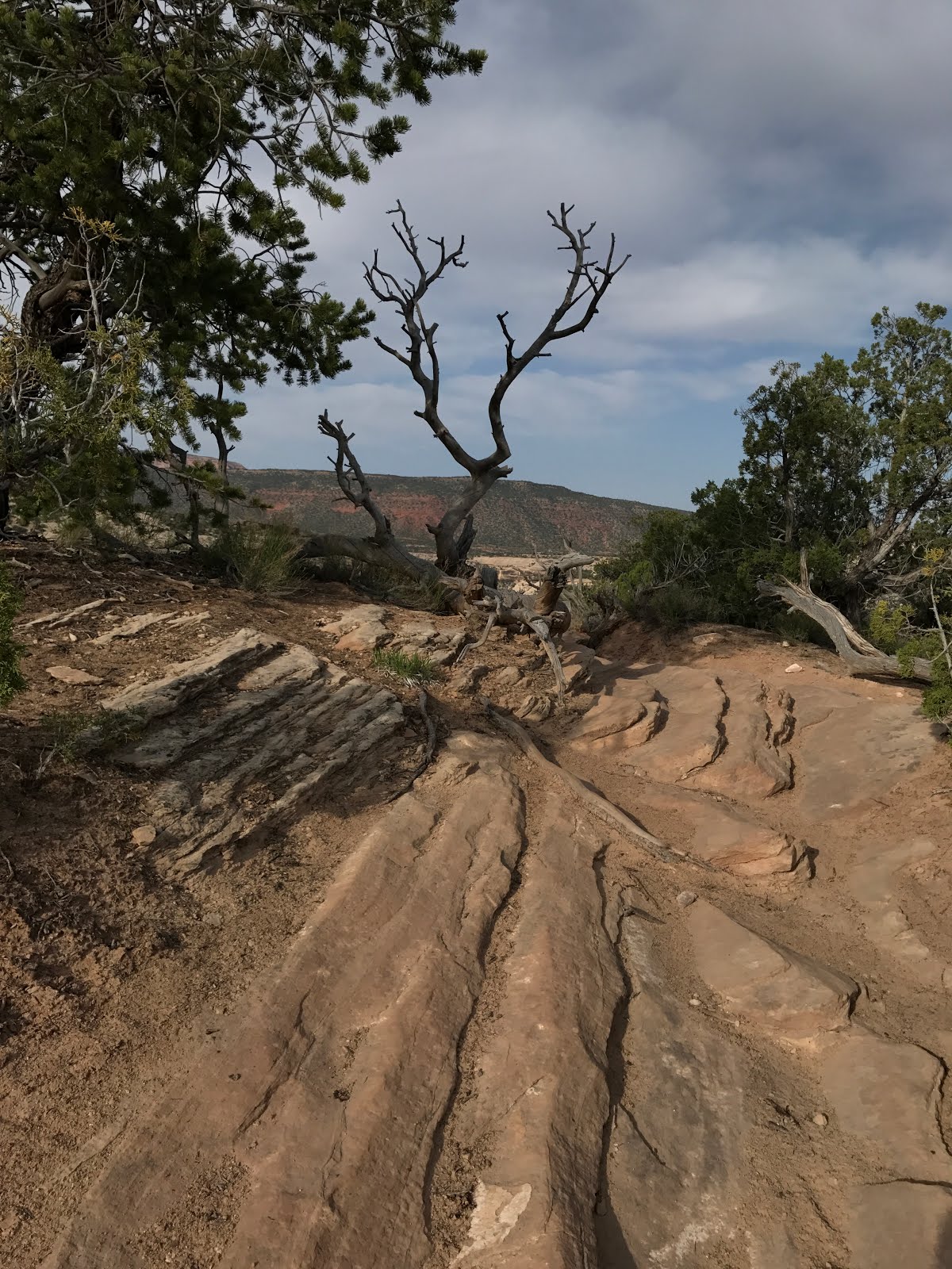
At 11:30 I headed out on a 10-mile loop-hike that went over
a mesa and then into the canyon to all 3 bridges. It’s a beautiful area. Plenty
of folks drive the 9-mile loop and look down on the bridges. A few hike down to
the bridges and back up, and even fewer hike the loop. That’s the loop I was describing at the
beginning of this post.

View from Sipapu Bridge Overlook.
 
Sipapu Bridge -- the 2nd (known) largest natural bridge in the world (after Rainbow Bridge in Lake Powell).
 
A thunder storm was brewing...

Kachina Bridge.

This (Kachina Bridge) is the "newest" bridge with regard to its stage of formation. It's so broad, it's hard to photograph.
I've mixed photos (different views of the bridges) from my 2nd day hiking in nicer weather in here with the stormy day photos.

It was a relief to come around the corner on the stormy day and see Owachomo Bridge and know that my van was not far away.
 
The sky the night of the thunder and lightning was still stirred up.
I’d
only planned to stay one night but the next morning I decided to stay another day.
I’d missed the trail to the ruins and I heard they were nice so I decided to go
back down to the first bridge, find those ruins, and then hike a side canyon.
It took a while to find the ruins but they were pretty amazing. Probably
because they are well hidden they’re well intact with the roof still on the
kiva. Too bad I hadn’t brought my Native American flute with me. It had a very spiritual feeling and the acoustics
on that ledge would’ve been pretty amazing -- the site was quite inspiring. Of
course, if I’d spent more time than I did on the site, all those folks that
hiked the nearly level .3 miles down the trail from the road to overlook the
ruins from WAY above might’ve been disappointed that I was in their photos.

The shapes of these doors in how the ruins got their name.
   
The Kiva roof is mostly intact. Peering through holes in the wall seemed almost like spying, but it gave a good idea of what their lifestyle must've been like.

Today on my way out of the park I hiked that short
trial to see what it looks like from the overlook. Not NEAR as impressive. This is zoomed WAY in (10x).
I also hiked down to the
middle bridge (Kachina) to see if I could find the pictographs I missed when I did the loop
hike. When I got to that bridge the weather was really stirring up; winds were
very strong and kicking up dust storms and it was raining. I’m not surprised I
didn’t see any pictographs. But today’s weather was like yesterday’s, it was nice in the morning. The pictographs were fairly subtle and up quite high.

The Kachina figure here is why the bridge got its name.
   
I'm finding all sorts of colors of cacti blooms.
I'm camped at an RV park about 45 miles from Capitol Reef National Park. I haven't been plugged in at a campsite for 10 days. Now that my clothes and I are squeaky clean I'll head into the Park tomorrow (no hook ups, no showers). Hopefully this is ready to post. It's starting to act up so I'm going to get it posted now before the whole thing crashes.
|
No comments:
Post a Comment